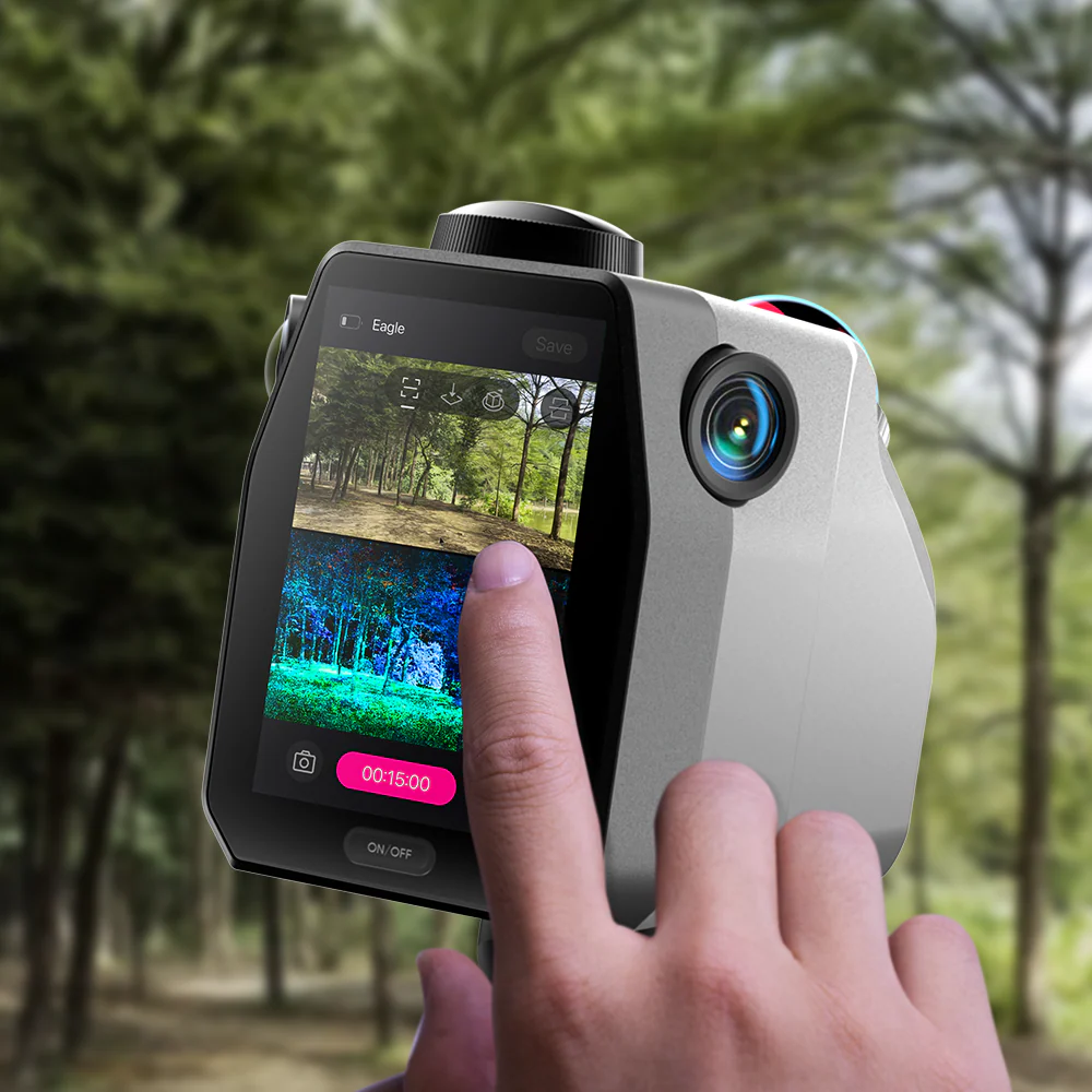
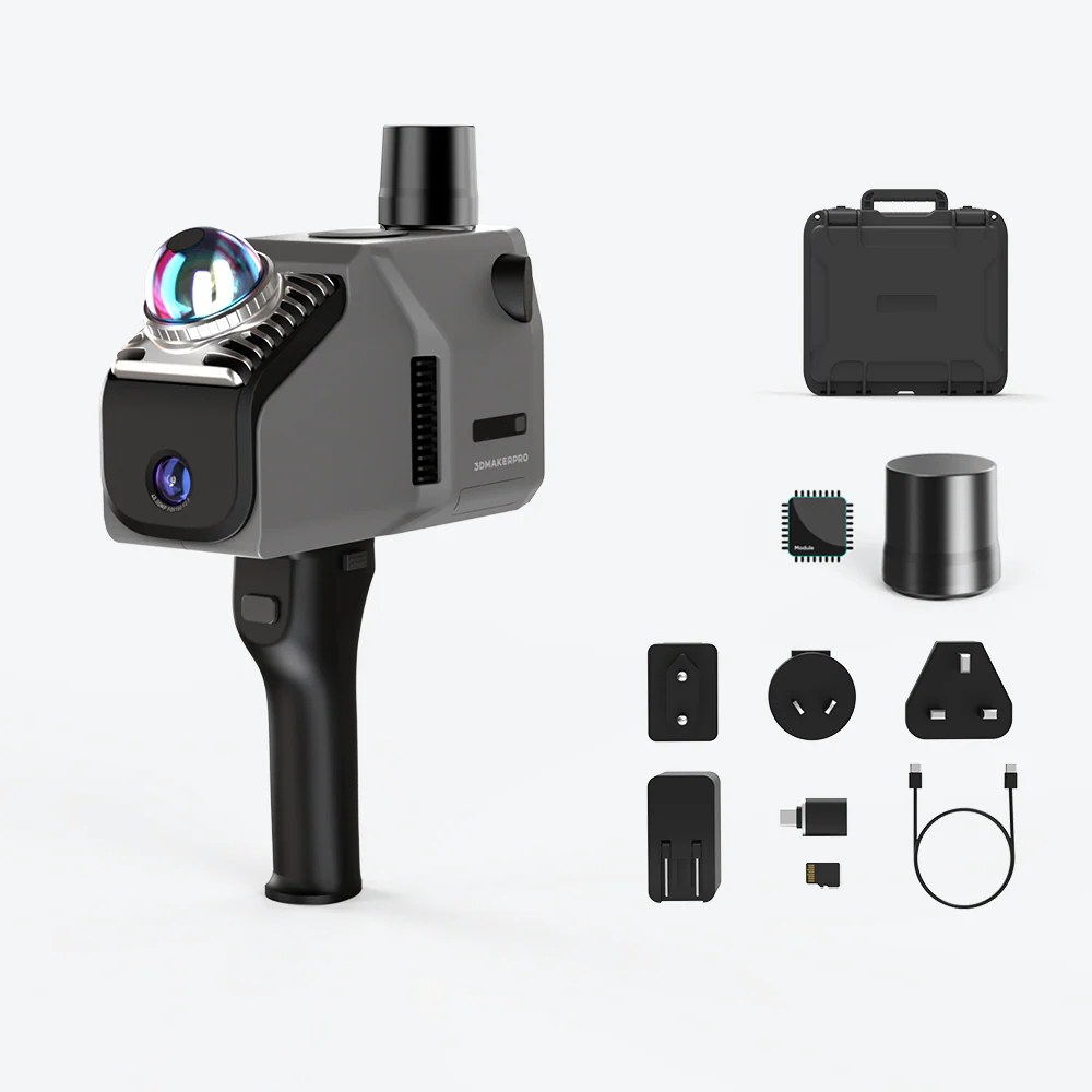
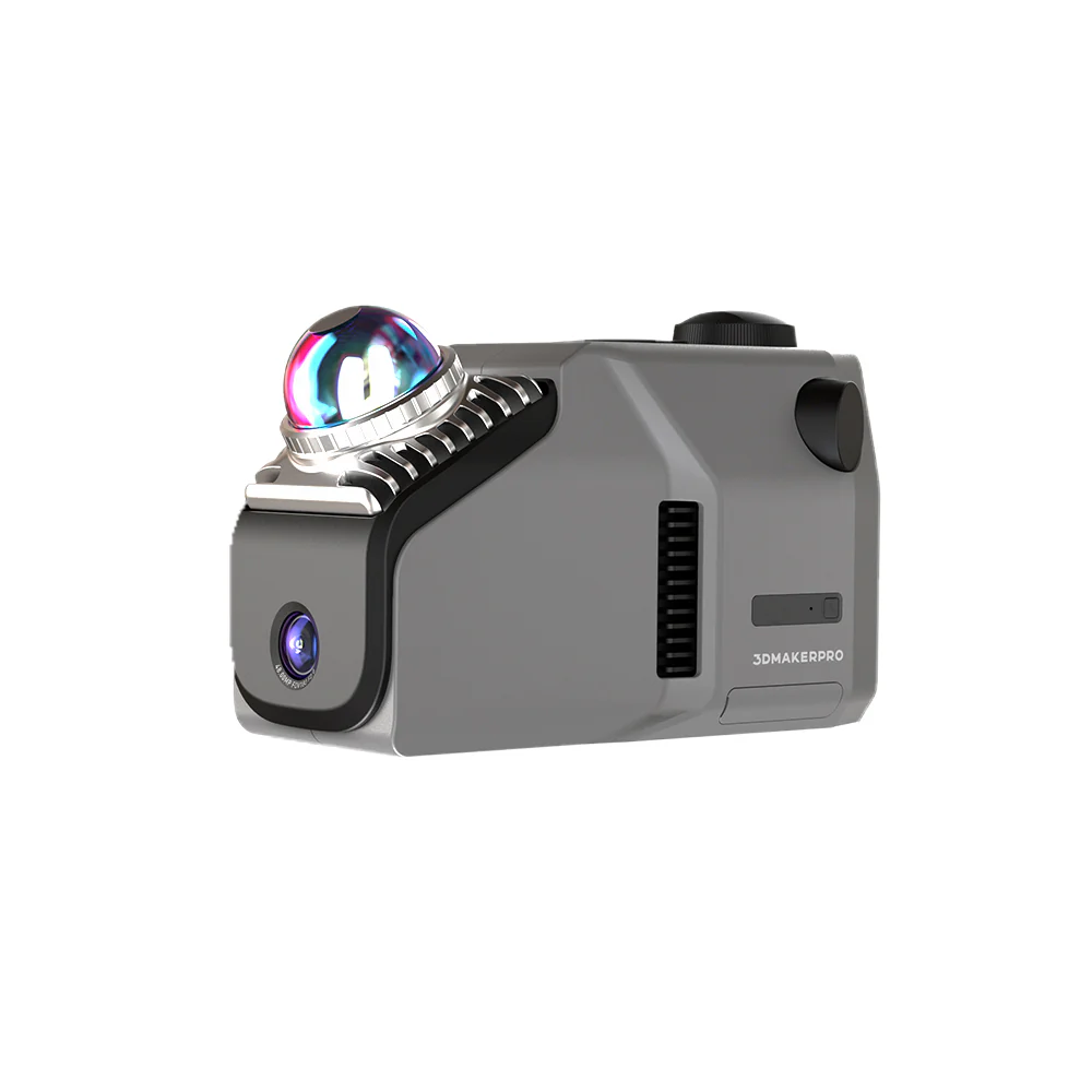
3DMakerpro LiDAR Scanner
Eagle
3DMakerpro "Eagle"
Eagle is 3DMakerpro’s high-performance spatial scanner, combining high precision, wide coverage, and user-friendly operation. Designed for professionals seeking efficiency and accuracy, Eagle offers an end-to-end solution from data acquisition to 3D production, enabling large-scale 3D scene modeling within minutes. Whether for architectural surveying, film production, or virtual exhibitions, Eagle streamlines the entire process into a one-stop experience.
High-Performance Spatial Scanning
70 M
SCANNING RADIUS
Provides a scanning radius of up to 70 meters under conditions of 80% reflectivity.
2 CM
ACCURACY
High-Precision, Wide-Range Scanning
Ultra-Wide Coverage Angle
Entering the Era of Colorful Scanning
48 MP
CAMERA
8K HDR
IMAGING
3D Gaussian Splatting
Eagle transforms captured photos into Gaussian distributions to generate highly realistic 3D scenes. The accompanying software creates high-quality Gaussian-Splatting 3D content, compatible with Unreal Engine, allowing for the rapid construction of premium 3D environments.
Immersive Panoramic Tours
All-in-one Scanning Solution
Excepcional experiencia de usuario
No complex calibration is required, saving up to 50% of preparation time compared to traditional devices.
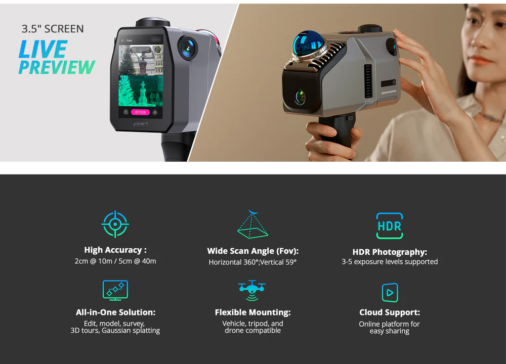
Equipped with a 3.5-inch display, Eagle offers three real-time display modes during data collection: point cloud, photos, or split-screen point cloud/photos. After collection, users can instantly review point cloud projects, GPS trajectories, and photos.
Eagle collects up to 200,000 points per second, maintaining data quality even at speeds of 20 km/h, meeting the needs of dynamic operations in various vehicles.
Platform and Software
Whether it’s architectural surveying, film production, or virtual exhibitions, Eagle’s workflow and companion software ensure a seamless experience from point cloud capture to final presentation.
One-click noise removal that rapidly clears your point cloud, streamlining your workflow and boosting efficiency.
Algorithm-driven point cloud optimization to improve accuracy.
Post-Processing Software
The post-processing software allows users to refine and edit point cloud data, with output formats including PLY, PNG+OBJ, and Gaussian-Splatting PLY (completely free of charge for non-commercial visual sharing), all completely free of charge.
Modeling Software
Eagle includes standalone modeling software for point cloud modeling and surveying.
A free plan is available, covering essential features.
What's in the Box
Technical specifications
Characteristic | Eagle LiDAR Scanner | |
---|---|---|
Accuracy | 2 cm @ 10 m; 3 cm @ 20 m; 5 cm @ 40 m | |
Scan Radius | 40–70 m (measured at >10% or >80% reflectivity) | |
Scan Range | 80–140 m | |
Scan Angle | Horizontal 360°, Vertical 59° | |
Point Cloud Frequency | 200,000 points / second | |
Laser Light Source | 905 nm | |
Eye Safety | Class 1 (IEC 60825-1:2014) | |
HDR Mode | Supports 3–5 EV | |
Color Texture | Max Edition: 4 × 48 MP fisheye cameras Standard Edition: 1 × 48 MP fisheye camera | |
Image Quality Output | 8K Panoramic Color Output | |
Data Interface | USB Type-C × 2 | |
Network Support | Wi-Fi 5 | |
Screen | 3.5″ | |
Output Formats | 3D Color Point Cloud (PLY); 3D Gaussian Splatting (PLY); 3D Colored Polygonal Model (OBJ); 3D Panoramic Tour Data (OBJ) | |
Built-in Battery | 12,000 mAh (supports 1 hour of work; external power supply supported) | |
Dimensions | 115 × 181 × 106 mm | |
Weight | 1.5 kg | |
Configuration | 8 Cores @ 2.4 GHz, 32 GB (TF card expansion supported) | |
Recommended Configuration | Processor: Intel Core i7 Memory: 64 GB RAM Graphics Card: NVIDIA RTX 4060, 16 GB VRAM | |
Minimum Configuration | Processor: Intel Core i7 Memory: 32 GB RAM Graphics Card: NVIDIA RTX 3060, 12 GB VRAM Note: Gaussian Splatting is only supported on NVIDIA GPUs. |